
File:KingdomKongo1711.png
Size of this preview: 640 × 447 pixels.
| |
This is a file from the Wikimedia Commons. Information from its description page there is shown below.
Commons is a freely licensed media file repository. You can help. |
 |
This map image could be recreated using vector graphics as an SVG file. This has several advantages; see Commons:Media for cleanup for more information. If an SVG form of this image is already available, please upload it. After uploading an SVG, replace this template with {{ vector version available|new image name.svg}}. |
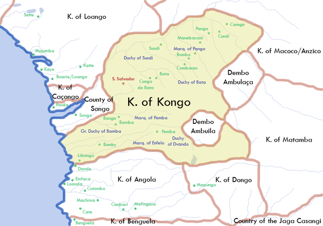
Summary
en: A map of the Kingdom of Kongo, as of 1711. Contact me at enwiki ( en:User:Happenstance) for the Photoshop file, if you want to make any other versions/changes.
Licensing
| This file is licensed under the Creative Commons Attribution-Share Alike 2.5 Generic license. | ||
|
File usage
The following pages on Schools Wikipedia link to this image (list may be incomplete):
Wikipedia for Schools...
Schools Wikipedia was launched to make learning available to everyone. SOS Childrens Villages is there for the children in our care until they are ready for independence. Why not try to learn more about child sponsorship?