
File:Dardanelles map2.png
Size of this preview: 560 × 480 pixels.
| |
This is a file from the Wikimedia Commons. Information from its description page there is shown below.
Commons is a freely licensed media file repository. You can help. |
 |
This map image could be recreated using vector graphics as an SVG file. This has several advantages; see Commons:Media for cleanup for more information. If an SVG form of this image is already available, please upload it. After uploading an SVG, replace this template with {{ vector version available|new image name.svg}}. |
Summary
Español: Estrecho de los Dardanelos
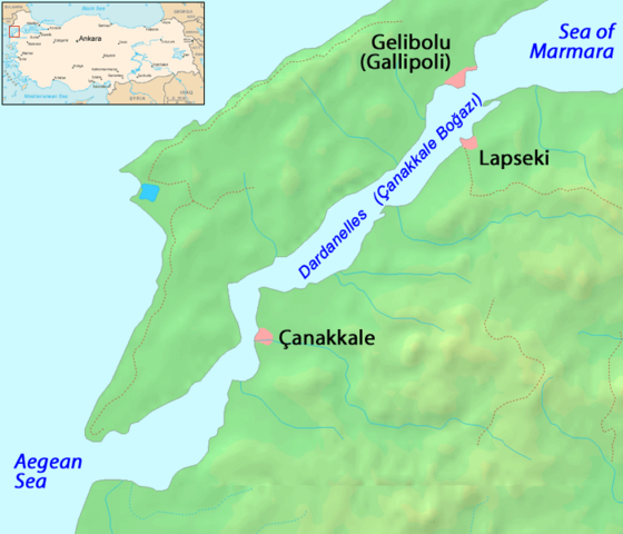
Map of the Dardanelles. Modified version of Image:Dardanelles map.png
Image history of en:Image:Dardanelles map2.png:
(del) (cur) 23:48, 25 September 2005 . . ChrisO . . 700x600 (125686 bytes) (Amended version of :Image:Dardanelles map.png {{PD}})
 |
This work has been released into the public domain by its author, ChrisO at the English Wikipedia project. This applies worldwide. In case this is not legally possible: |
File usage
The following pages on Schools Wikipedia link to this image (list may be incomplete):
A background to Schools Wikipedia
SOS Children chose the best bits of Wikipedia to help you learn. SOS Children works in 133 countries and territories across the globe, helps more than 62,000 children, and reaches over 2 million people in total. There are many ways to help with SOS Childrens Villages.