
File:Louvre Access Map.png
Size of this preview: 640 × 427 pixels.
| |
This is a file from the Wikimedia Commons. Information from its description page there is shown below.
Commons is a freely licensed media file repository. You can help. |
Summary
| Description |
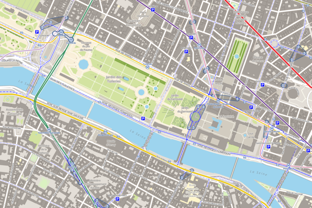
Français : Carte montrant les stations de métro, de bus et les parcs de stationnements autour du musée du Louvre de Paris. Cette carte est réalisée grâce aux données d' OpenStreetMap et grâce aux logiciels libres TileMill, PostgreSQL, PostGIS et osm2pgsql. Les logos RATP de la carte proviennent de File:Metro-M.svg et File:Paris_logo_bus_jms.svg.
|
| Date | 28 November 2012, 00:58:55 |
| Source | Own work |
| Author | Benh LIEU SONG |
Licensing
|
File usage
The following pages on Schools Wikipedia link to this image (list may be incomplete):
More information
Wikipedia for Schools is one of SOS Childrens Villages' many educational projects. SOS Children's Villages is there for the children in our care until they are ready for independence. Have you heard about child sponsorship? Visit our web site to find out.