
File:Matabeleland.png
Size of this preview: 466 × 480 pixels.
| |
This is a file from the Wikimedia Commons. Information from its description page there is shown below.
Commons is a freely licensed media file repository. You can help. |
| Description |
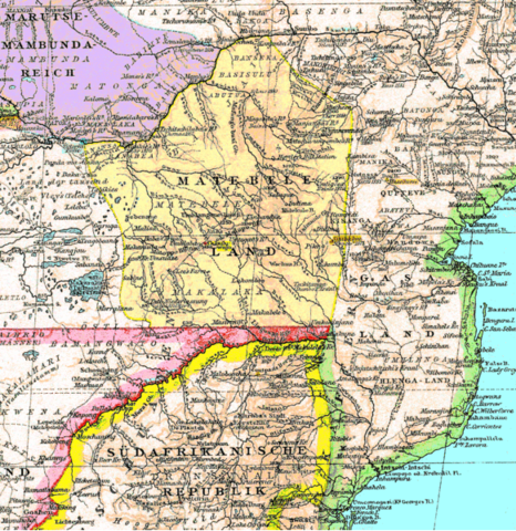
English: An 1887 map of southern Africa showing Matabeleland (part of present-day Zimbabwe).
|
|||||
| Date | 9 March 2008 | |||||
| Source | Modified version of Image:Matabeleland.gif. | |||||
| Author | Scanned by Ulamm ( talk · contribs), modified by Fvasconcellos ( talk · contribs) | |||||
| Permission ( Reusing this file) |
|
File usage
The following pages on Schools Wikipedia link to this image (list may be incomplete):
A background to Schools Wikipedia
This selection has made Wikipedia available to all children. SOS Children's Villages helps those who have nothing and no one, giving them back the famly they have lost and bringing them the very best opportunities for a happy, healthy future. Have you heard about child sponsorship? Visit our web site to find out.