  | 
          
            This is a file from the  Wikimedia Commons. Information from its  description page there is shown below.  Commons is a freely licensed media file repository.  You can help. 
           | 


✓ The source code of this  SVG is  valid.


           | 
            
            | 
           This  vector image was created with  Inkscape, and then  manually edited. | 


        Summary 


           | DescriptionTopographic map of Cape Verde-en.svg | 
           
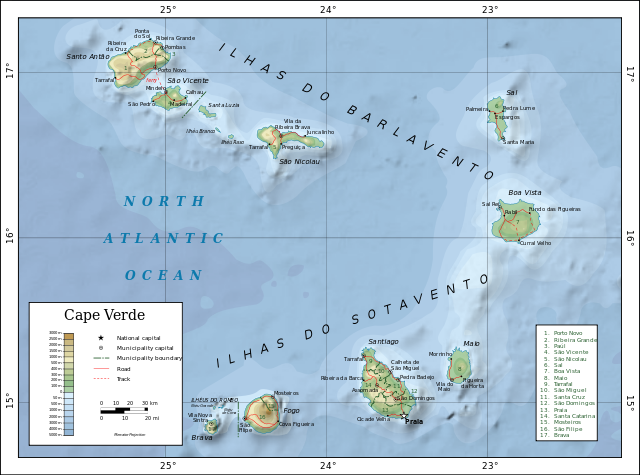
             English: Topographic map of  Cape Verde. 
            Dansk: Topografisk kort over  Kap Verde. 
            Español: Mapa topográfico de  Cabo Verde. 
            Suomi:  Kap Verden topografinen kartta. 
            Français : Carte topographique du  Cap-Vert. 
            Македонски: Карта на  Зелен ’Рт. 
            Русский: Топографическая карта  Кабо-Верде.  Македонски | 
          
          
           | Date | 
           19 May 2008 | 
          
          
           | Source | 
           Self-made in Inkscape. 
             - Boundaries, roads, and place names based on a public domain CIA map ( http://www.lib.utexas.edu/maps/africa/cape_verde_rel_2004.jpg).
 
             - Topography based on public domain GLOBE data from NOAA ( http://www.ngdc.noaa.gov/mgg/topo/gltiles.html).
 
             - Bathymetry from  NGDC ETOPO2.
 
             - Shaded relief derived from  SRTM30_PLUS data.
 
             
            | 
          
          
           | Author | 
           Oona Räisänen ( Mysid) | 


              | 
           This SVG file uses embedded text that can be easily translated into your language using  this automated tool.  Learn more. You can also download it and translate it manually using a text editor. 


            | 


         Licensing 


           I, the copyright holder of this work, hereby publish it under the following licenses:
           
            
               | 
             Permission is granted to copy, distribute and/or modify this document under the terms of the  GNU Free Documentation License, Version 1.2 or any later version published by the  Free Software Foundation; with no Invariant Sections, no Front-Cover Texts, and no Back-Cover Texts. A copy of the license is included in the section entitled  GNU Free Documentation License.  http://www.gnu.org/copyleft/fdl.htmlGFDLGNU Free Documentation Licensetruetrue 
              | 


           You may select the license of your choice.
           | 


       File usage
       
        The following pages on Schools Wikipedia link to this image (list may be incomplete):


       This file contains additional information, probably added from the digital camera or scanner used to create or digitize it. If the file has been modified from its original state, some details may not fully reflect the modified file.
        
       
      You can learn about nearly 6,000 different topics on Schools Wikipedia. SOS Childrens Villages believes education is an important part of a child's life. That's why we ensure they receive nursery care as well as high-quality primary and secondary education. When they leave school, we support the children in our care as they progress to vocational training or higher education. There are many ways to help with SOS Children's Villages.